Purpose of the flight and payload description
The purpose of the high altitude solar cell calibration program was to produce air mass zero (AM0) standard solar cells that could be used for accurately setting solar simulator intensities. The program was started in 1962 by the Jet Propulsion Laboratory of the California Institute of Technology in Pasadena and endured for more than 40 years.
Since the output of solar cells is spectrally selective, the electrical power derived from solar cells depends on the total intensity and the spectral distribution of the light source: the Sun. Attempts were made to procure a laboratory light source which has the same spectral character and intensity as the Sun. However, such attempts have been complicated as different types of radiation sensing devices, such as pyrheliometers and thermopiles, have been used which can not be accurately calibrated on either a total intensity or spectral intensity basis. To overcome this was introduced the concept of flying cells on a balloon, to measure their output at altitudes, to recover the cells and to use them as reference standards. The calibrated standard solar cell is placed in the solar simulator beam, and the beam intensity is adjusted until the standard solar cell reads the same as it reads on the balloon.
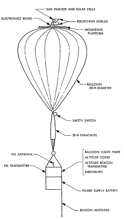
Althought some modifications were introduced over time, the main components of the balloon flight system were maintained along the entire program: a sun tracker, a helium-filled balloon, a telemetry system, and a battery power supply, as shown in the scheme at left (click for more detail). The sun tracker was mounted on the balloon apex, which is the most stable position of the balloon system. The telemetry transmitter and battery power supply, along with several instruments for measuring altitude, were suspended in a second gondola beneath the balloon. An electrical cable, incorporated into the balloon during manufacture, connected the top and bottom payloads.
The solar tracker was used to position the solar cell payload toward the sun, independent of balloon movements. The tracker was capable of movement in both elevation and azimuth to maintain an "on-sun" condition within +2 deg. A reflection shield attached to the solar tracker was used to prevent unwanted reflected light from reaching the solar cell payload. The tracker and associated electronics boxes were mounted on a plywood disk 6 ft in diameter, which, in turn, was bolted to the balloon top end fitting. The plywood disk permited the tracker to "float" on top of the helium bubble.
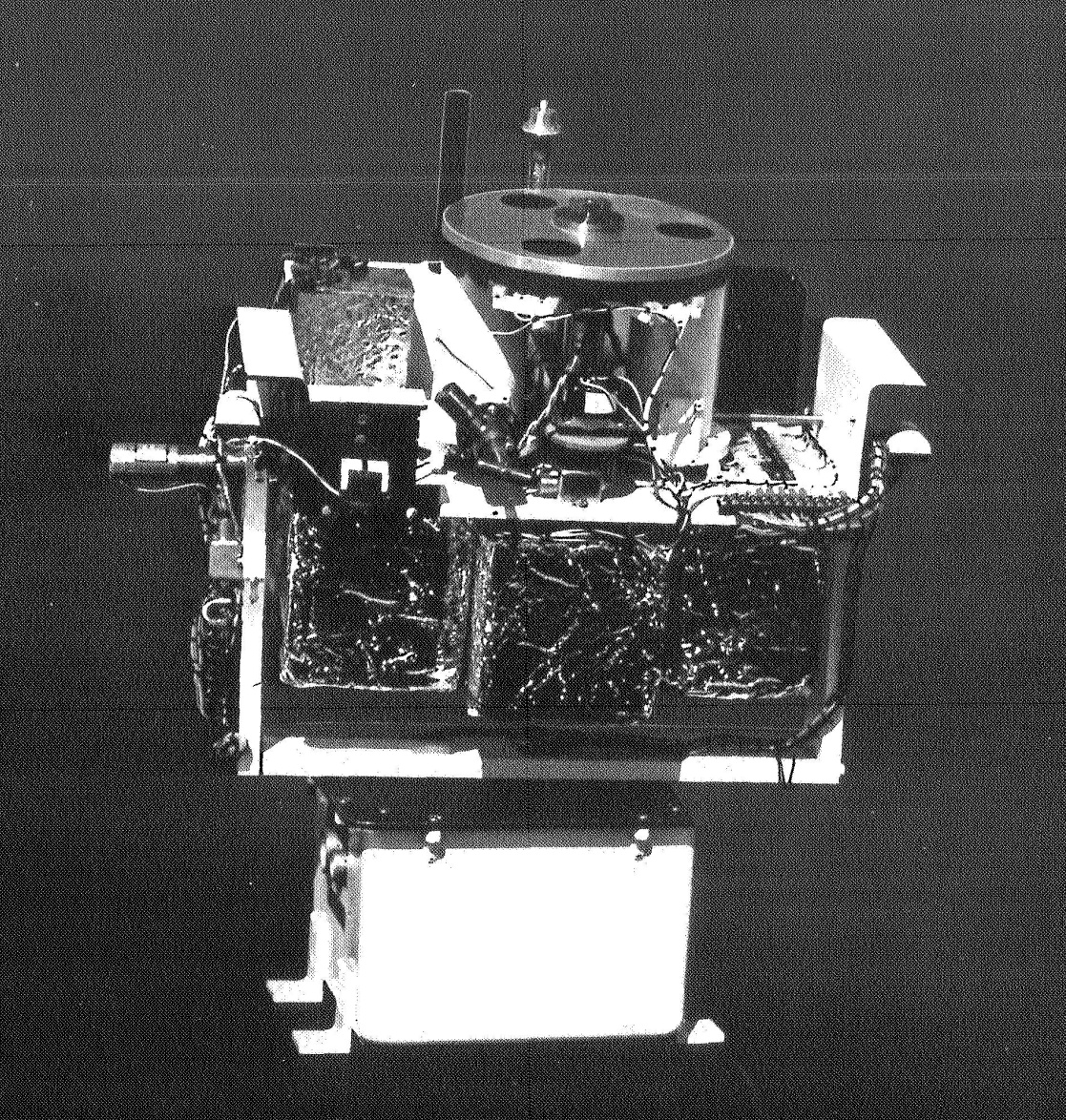
On this flight, for the first time during this program, the primary payload was not a group of solar cells. A special JPL-designed payload consisting of two evacuated radiometers with a filter and shutter assembly was prepared for testing on the solar tracker atop the balloon. The assembly provided space for four silicon solar cells below the rotating filter and chopper assembly. Three insulated and temperature-controlled electronic containers were required with this system, as well as a liquid nitrogen container for the purpose of maintaining an ultra-high vacuum within the radiometer case. The purpose of the experiment was to measure the solar constant more accurately, as well as to gather data in selected wavelength bands.
Details of the balloon flight

Balloon launched on: 8/20/1968 at 8:41 cdt
Launch site: University of Minnesota Airport, New Brighton, US
Balloon launched by: Litton Industries Inc.
Balloon manufacturer/size/composition: Zero Pressure Balloon SF-85.4-150-NS-06
Flight identification number: LITTON 3050
End of flight (L for landing time, W for last contact, otherwise termination time): 8/20/1968 at 17:22 CDT
Balloon flight duration (F: time at float only, otherwise total flight time in d:days / h:hours or m:minutes - ): 8 h 45 m
Landing site: 3 miles SW of Boyd, Winsconsin, US
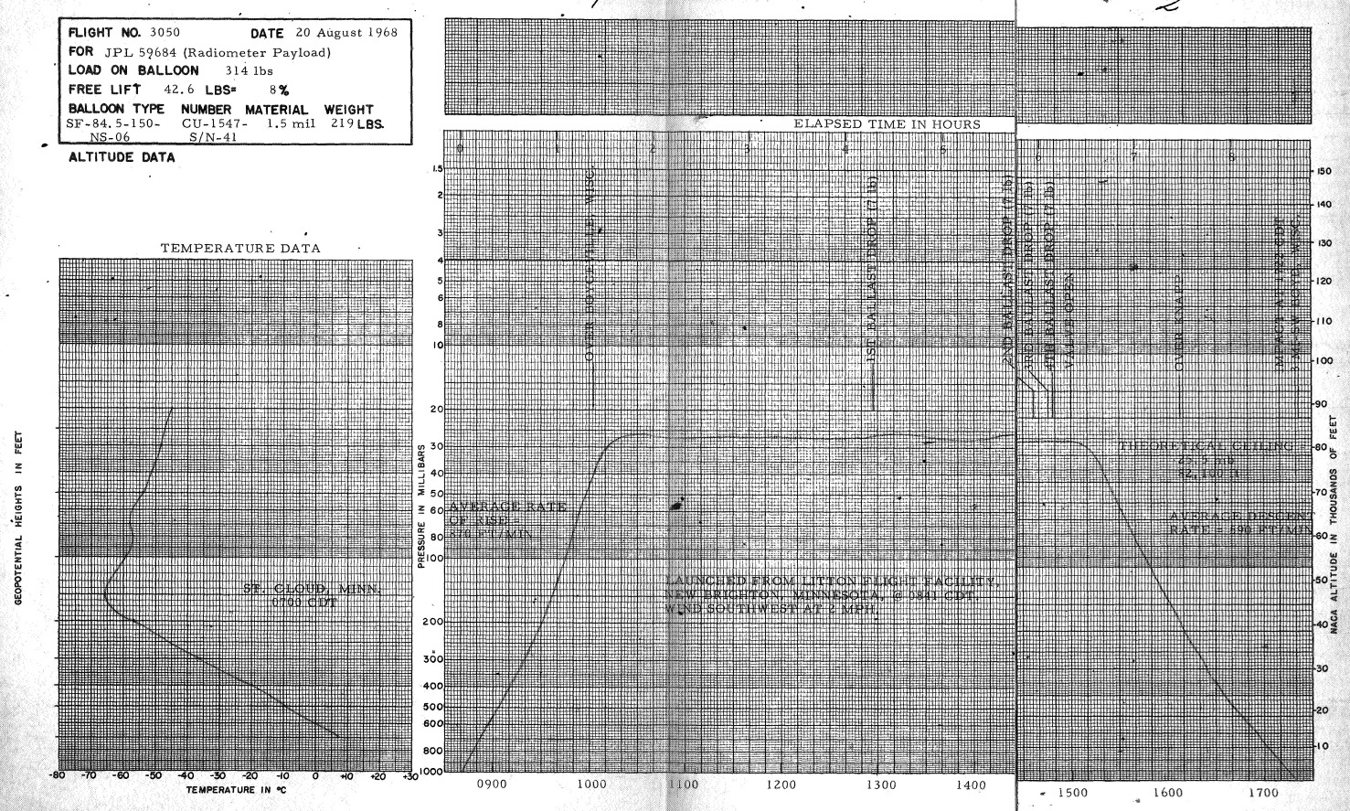
The balloon was launched by dynamic method from the Litton Flight Facility located near New Brighton, Minnesota at 8:41 CDT on August 20, 1968 as Flight No. 3050. The balloon ascended on an easterly heading to a position over Boyceville, Wisconsin, at 71,000 feet. The system remained in the vicinity of Boyceville and Knapp, Wisconsin, from 10:00 to 16:08 CDT, when at 43,000 feet during descent it again took an easterly heading. Impact was at 17:22 CDT, 50 yards into a woods, 3 miles southwest of Boyd, Wisconsin. The lower payload came down through the trees, actuating the impact switches when it struck the ground. The lower payload did not move from that position. When the recovery crew arrived at the site of impact, the balloon was still standing and wind conditions were calm. The crew then pulled the upper payload gently to the ground by means of the balloon. All the equipment was recovered from the woods that afternoon.
External references
- Active cavity radiometric scale, international pyrheliometric scale, and solar constant J. Geophys. Res., 76(19), 4325
- Results of the 1968 balloon flight solar cell standardization program Technical Report 32-1426, Jet Propulsion Laboratory, December 1, 1969
- Solar-tracker balloon flights 3048, 3049, and 3050 Final report (1968) Technical Report - Litton Systems, Inc.; Minneapolis, MN, United States
10322If you consider this website interesting or useful, you can help me to keep it up and running with a small donation to cover the operational costs. Just the equivalent of the price of a cup of coffee helps a lot.


